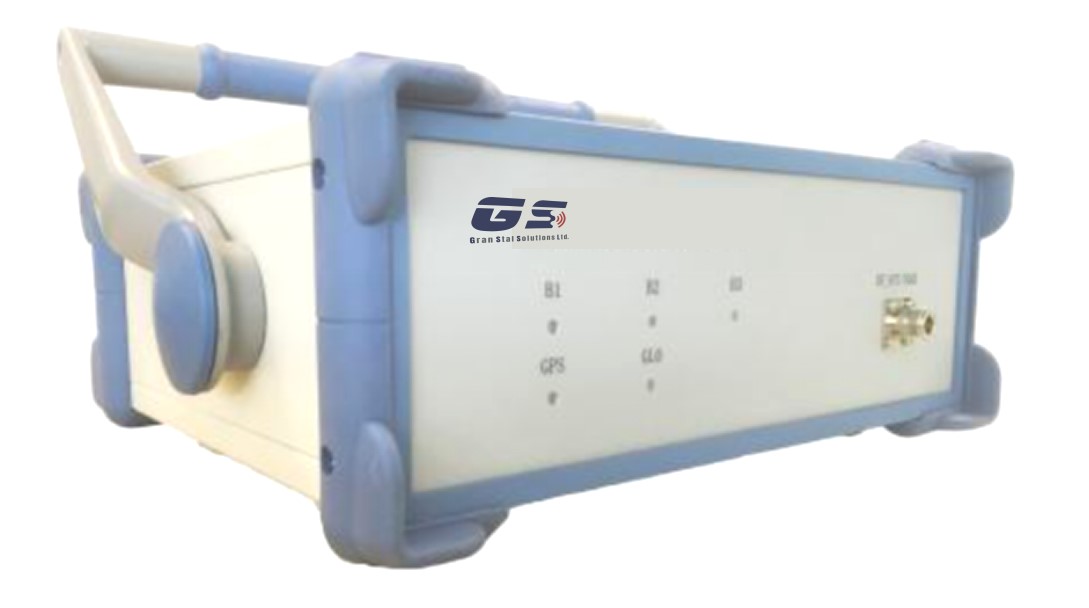
 Satellites and subsystems > Orbit determination and control > GNSS and GPS receivers > GS-SIM200 GNSS Simulator GNSS Signal Simulation

Key highlights
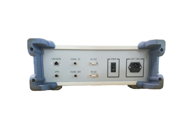
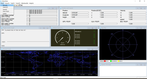
The GS-SIM200 GNSS Simulator supports all possible scenarios, from simple setups with static satellites all the way to flexible scenarios generated in real-time with up to 80 dynamic GPS, Glonass and BeiDou satellites. The signal strength of individual satellites can be controlled in real-time in order to simulate conditions of restricted satellite visibility. The set of satellites to be simulated is continually calculated based on the number of available channels, the satellite visibility and the constellation geometry. The satellite visibility can be influenced by the user by configuring an elevation mask. The GS-SIM200 can simulate a moving user in various ways, trajectories can be defined in the form of waypoints, or they can be imported and played back using routes that were recorded in NMEA format with a GNSS receiver. Another approach to motion simulation is to feed externally generated trajectories (i.e. from outside the GS-SIM200) via SCPI to the GS-SIM200. Ionospheric effects, tropospheric influences, signal obscuration and multipath effects are among the key factors that can impact the quality and availability of GNSS signals. Using the GS-SIM200, such influences can be quickly and easily configured to obtain a realistic simulation of receiving conditions.
Disclaimer: satsearch is not responsible for any mistakes on this page, although we do our best to ensure correctness. Please report any mistakes to us.
Last updated: 2025-09-26
Technical specs
Export