 Satellites and subsystems > Satellite payloads > Satellite cameras > T-Scout
Key highlights
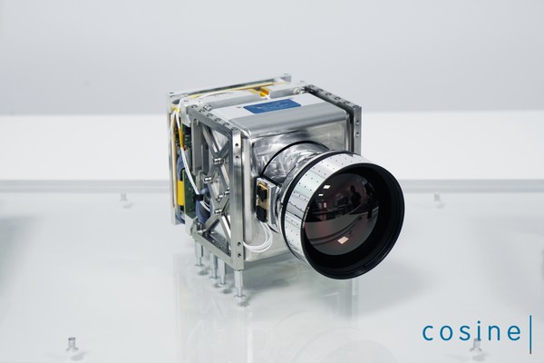
The Cosine T-Scout is a multispectral infrared imager designed to have high resolution for small satellite applications.
The onboard data handling system is made for real-time data processing, enabling Level-2 generation onboard and thereby drastically reducing the amount of data to download and process on Earth.
It is designed to be operated on nano, micro, and larger satellites. T-Scout utilizes the latest developments in detector technology and calibration.
Applications
- Agriculture
- Detect soil moisture, irrigation levels, and water content of plants
- Aquaculture
- Detect proxies related to hydropower and tourism
- Defense & security
- Assess accessibility of vehicles based on surface characteristics
- Finance & insurance
- Identify (environmental) risks, land & water productivity
- Forestry
- Assess fire risks, early warning, and actual monitoring of fires
- Mining
- Environmental impact assessment
- Oil & gas asset management
- Monitoring fires and plumes
- Smart cities
- Assess urban heat islands for city planning
Disclaimer: satsearch is not responsible for any mistakes on this page, although we do our best to ensure correctness. Please report any mistakes to us.
Last updated: 2026-03-10

T-Scout
Export